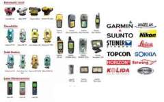
* * GPS Magellan Triton 400 * *
Case Rubber armored impact-resistant plastic, water-resistant seal, IPX-7
Pre-Loaded Maps Built-in basemap of Contiguous U.S., Alaska, Canada and Worldwide Geographic Boundaries
Size 4.65" x 2.16" x 1.22"
Weight 6.6 oz ( 187.1 g) - w/ battery
Screen Size 2.2" ( 5.59cm) diagonal, QVGA ( 240 x 320) resolution, LED backlit
SD RAM SD Card
Memory available for map storage Secure Digital ( SD) Card
Antenna Type Built-in multidirectional patch
Keypad Nine direct-access keys
Operating Range 14 to 140° F ( -10 to 60° C)
PERFORMANCE
GPS SiRF Star IIIâ„¢ 20 channels, WAAS/ EGNOS
Acquisition Time Hot: 20 seconds, Cold: 60 seconds, Initial: 2 minutes
Update Rate Once per second
GPS Accuracy 3 to 5 meters ( 10 - 16 feet) - WAAS/ EGNOS, < 7 meters ( 15 feet) - GPS only
Languages English, French, German, Dutch, Italian, Spanish, Danish, Norwegian, Swedish, Finnish, Portuguese.
Coordinate Systems Latitude/ Longitude, UTM, OSGB, Irish, Swiss, Swedish, Finnish, German, French, USNG, MGRS, Indian, Dutch.
POWER
Source Two AA Batteries ( not included)
Battery Life 10 hours


